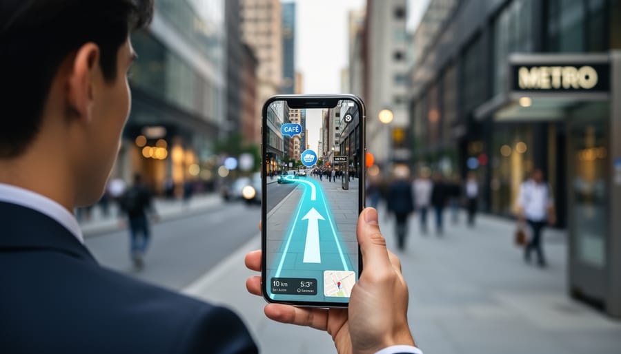
Augmented Reality City Navigation Maps are revolutionizing how people explore urban landscapes across the United States. This innovative technology overlays digital information directly onto real-world views through smartphone cameras or smart glasses, providing an incredibly immersive and intuitive navigation experience. Imagine walking through a bustling city street where arrows pointing to your destination appear right on the pavement in front of you, or historical facts about a building pop up as you look at it. This trending tech goes beyond traditional GPS by offering real-time, context-aware guidance that can significantly enhance travel, tourism, and daily commuting. Users are actively seeking ways to simplify complex urban environments and discover hidden gems effortlessly. The integration of AI further refines these maps, anticipating user needs and offering personalized recommendations for restaurants, attractions, and public transport connections. Expect this technology to become a standard feature in many major cities.
- What is the core technology behind AR City Navigation Maps? - The core technology behind AR City Navigation Maps involves advanced computer vision, sensor fusion (GPS, accelerometer, gyroscope), and precise location-based services. These elements work together to accurately identify a user's position and orientation, then seamlessly overlay digital content onto the live camera feed of a smartphone or smart glasses, creating an interactive real-world view.
- How accurate are AR navigation systems in dense city environments? - AR navigation systems are continually improving in accuracy, even in dense city environments. Utilizing a combination of GPS, visual positioning systems (VPS) that map visual features, and Wi-Fi/cellular triangulation, they can achieve high precision. While challenges remain in areas with poor satellite signals, ongoing technological advancements are making these systems increasingly reliable for urban use.
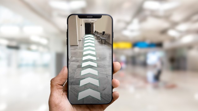
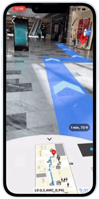
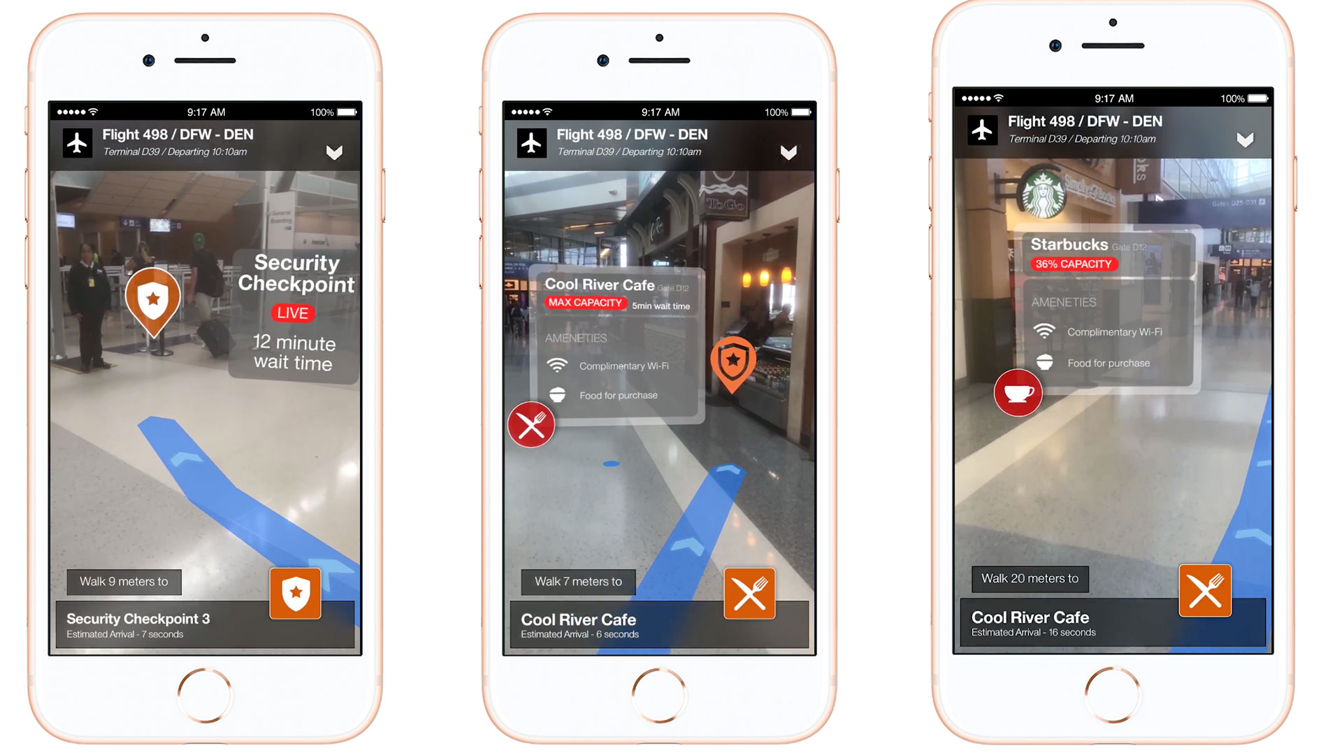
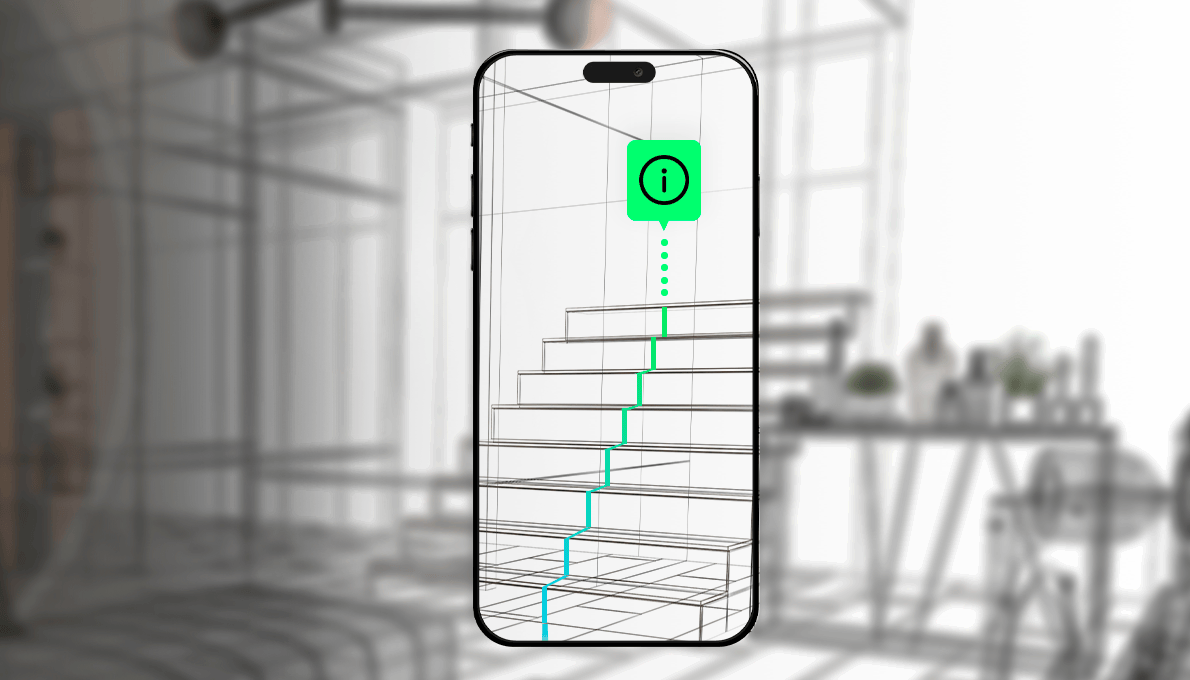
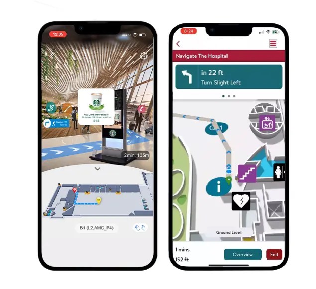
- Can AR City Navigation be used for indoor wayfinding? - Yes, AR City Navigation is highly effective for indoor wayfinding, especially in large complexes like airports, shopping malls, or museums. Indoor positioning technologies such as Wi-Fi, Bluetooth beacons, and visual markers are integrated with AR to provide step-by-step directions. This allows users to navigate complex interiors with digital arrows and information appearing directly in their view.
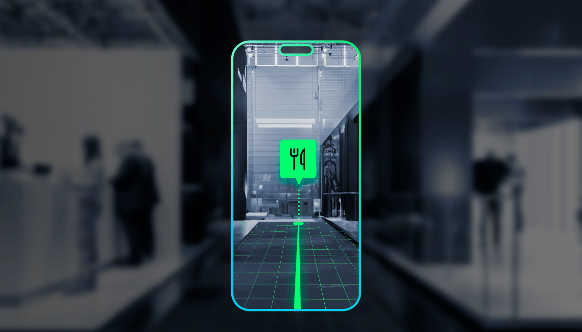
- What kind of content can AR City Navigation display? - AR City Navigation can display a rich variety of content. This includes real-time directional arrows, superimposed street names, historical information about landmarks, interactive menus for restaurants, public transport schedules, and virtual signage for businesses. The content is dynamically tailored to the user's location and viewing angle, enhancing context and utility significantly.
- Will AR navigation replace traditional map apps entirely? - AR navigation is unlikely to replace traditional map apps entirely but will significantly augment and enhance them. Traditional apps remain valuable for planning and overview, while AR excels in real-time, on-the-ground execution. Future mapping solutions will likely integrate both seamlessly, offering users the best of both worlds depending on their specific navigation needs and preferences.
- What are the privacy concerns associated with AR City Navigation? - Privacy concerns with AR City Navigation primarily revolve around data collection, including location data and camera feeds, which could potentially reveal sensitive personal information. Developers are working on robust encryption and anonymization protocols to protect user data. Users should review app permissions and privacy policies carefully to understand how their information is being used and secured.
- How does AR City Navigation handle accessibility features? - AR City Navigation is increasingly incorporating accessibility features to benefit diverse users. This includes audio guidance for visually impaired individuals, customizable visual cues for color blindness, and simplified interfaces for cognitive accessibility. Developers are focusing on inclusive design to ensure that these advanced navigation tools are usable and beneficial for everyone, regardless of their specific needs.
What are Augmented Reality City Navigation Maps?
Augmented Reality City Navigation Maps integrate digital navigational cues directly onto your real-world view via smartphone cameras or smart glasses. This technology provides an immersive experience, showing directions and points of interest superimposed on the actual environment. It transforms urban exploration by offering real-time, context-aware guidance that feels incredibly intuitive and natural for users.
How will AR navigation impact future urban travel?
AR navigation is poised to revolutionize urban travel by making it more intuitive, immersive, and personalized. Travelers will experience cities with digital information seamlessly blended into their physical surroundings, from walking directions projected onto sidewalks to historical facts appearing above buildings. This will reduce confusion, enhance discovery, and create a more engaging, efficient way to explore unfamiliar urban landscapes by 2026.
What devices support AR City Navigation?
Currently, AR City Navigation is primarily supported by smartphones equipped with AR capabilities and increasingly, by specialized smart glasses. As technology advances, more dedicated AR devices are expected to emerge, offering even more seamless and hands-free navigation experiences. The ecosystem is rapidly expanding to make this innovative mapping technology accessible to a broader user base in the coming years.
Can AR maps offer personalized recommendations?
Yes, advanced AR maps often incorporate AI to offer highly personalized recommendations. By analyzing user preferences, past behaviors, and real-time context, these systems can suggest nearby restaurants, attractions, or events tailored to individual interests. This intelligent integration ensures that users not only navigate effectively but also discover experiences perfectly aligned with their personal tastes, enhancing their overall city adventure.
Is AR City Navigation safe to use while walking?
AR City Navigation is designed with safety in mind. By projecting directions directly into the user's line of sight, it encourages users to keep their heads up and remain aware of their physical surroundings. This differs from traditional phone-based navigation, which often requires looking down at a screen. However, users should always exercise caution and remain vigilant of their environment, as with any navigation tool.
AR City Navigation: Your Guide to Immersive Urban ExplorationMaster AR City Navigation: How Augmented Reality Transforms TravelFuture of Travel: Experiencing Cities with AR Navigation MapsProven AR City Navigation Strategies for Seamless Urban JourneysUnlock Cities: A Step-by-Step Guide to AR NavigationSEO Meta Description: Discover how AR City Navigation Maps are revolutionizing urban exploration. Get real-time, immersive directions and personalized guides for your next city adventure.Recommended URL Slug: ar-city-navigation-maps-guideHave you ever wondered if navigating a new city could be as intuitive as seeing digital directions laid right onto the street in front of you? Augmented Reality City Navigation Maps are making this futuristic vision a tangible reality for travelers and urban explorers across the United States. This groundbreaking technology is rapidly transforming how we interact with our surroundings, blending digital information seamlessly with the physical world. People are genuinely asking whether this innovation will truly simplify their journeys and enhance their connection with urban environments.
Imagine holding up your smartphone or wearing advanced smart glasses in a busy downtown area. Instead of glancing down at a flat map, you see transparent arrows guiding you along the sidewalk, names of shops hovering above their storefronts, or historical anecdotes appearing next to iconic landmarks. This isn't science fiction anymore; it is the practical application of augmented reality, projected to be a staple in urban exploration by 2026. This immersive experience promises to remove the guesswork from finding destinations and unlock a richer, more contextual understanding of every street corner.
The Evolution of Urban Exploration with AR
Traditional maps and GPS systems have served us well for decades, providing essential guidance in unfamiliar territories. However, AR City Navigation elevates this experience by directly addressing common pain points such as spatial disorientation and information overload. Users often struggle to reconcile a 2D map with their 3D surroundings, a problem that AR effortlessly solves by placing digital cues directly within their line of sight. This intuitive approach minimizes distractions and allows for a more engaged observation of the environment.
What Makes AR City Navigation Stand Out?
- Real-Time Visual Overlays: Digital directions, points of interest, and navigational prompts appear seamlessly integrated into your live camera view.
- Contextual Information: AR maps provide relevant details about landmarks, businesses, and public services exactly when and where you need them.
- Enhanced Safety: With eyes up and on the real world, users can navigate more safely while remaining aware of their physical surroundings and potential hazards.
- Personalized Experiences: AI integration learns user preferences, offering tailored recommendations for dining, entertainment, and cultural sites.
The Profile of Next-Gen AR Navigation
The "casting profile" for effective AR city navigation systems demands specific traits for optimal performance. These systems require precise Height mapping, accurately rendering digital objects at their correct real-world elevations and distances. Their robust Build integrates advanced sensors, including GPS, accelerometers, gyroscopes, and high-resolution cameras, ensuring stable and reliable performance even in dense urban canyons. The visual Hair of the interface, metaphorically speaking, involves vibrant, clear digital overlays and intuitive graphical elements that enhance, rather than obstruct, the user's view. With sharp Eyes, the camera vision and object recognition capabilities identify landmarks and street signs with remarkable accuracy, making contextual information highly reliable. These systems are designed for a broad Age Range, featuring user-friendly interfaces that are accessible to tech-savvy millennials and older generations alike, promoting widespread adoption. Finally, their digital Ethnicity showcases adaptability to diverse urban landscapes and cultural nuances, providing relevant information whether you are in a historic district or a modern commercial hub.
What Others Are Asking?
What exactly is Augmented Reality City Navigation?
Augmented Reality City Navigation overlays digital directions and information onto a live view of the physical world through devices like smartphones or smart glasses. It provides an immersive, real-time guide, showing arrows on the street or details about buildings directly in your line of sight. This technology merges the digital with reality, offering an intuitive way to explore urban environments.
How does AR navigation differ from traditional GPS?
Traditional GPS provides a 2D map view with a moving dot, requiring users to interpret their surroundings. AR navigation, however, projects virtual cues directly into the user's real-world view, offering immediate, visual guidance on the environment itself. It eliminates the need to constantly switch focus between a screen and the physical world, making navigation more natural and engaging.
Is AR City Navigation widely available in the US now?
While still emerging, AR City Navigation is becoming increasingly available in major US cities through specialized apps and integrated features in popular mapping services. By 2026, its presence is expected to be significantly expanded, with more widespread adoption in urban centers and dedicated smart glasses offering even more seamless experiences. Early adopters are already experiencing its benefits.
What are the benefits of using AR maps for tourists?
For tourists, AR maps offer unparalleled benefits, transforming sightseeing into an interactive adventure. They provide real-time directions to attractions, highlight historical facts about landmarks as they are viewed, and suggest nearby points of interest. This immersive guidance reduces stress, enhances discovery, and allows tourists to experience a city with richer, context-aware information, making every step more engaging.
Can AR City Navigation improve daily commuting?
Absolutely, AR City Navigation can significantly improve daily commuting by providing clear, heads-up directions for walking or public transport. It can guide users through complex transit stations, point to the correct bus stop, or show the quickest pedestrian routes, all without requiring constant glances at a phone screen. This leads to more efficient and less stressful urban journeys for everyday users.
Final Thoughts on AR City Navigation
Augmented Reality City Navigation Maps represent a significant leap forward in how we interact with and understand our urban spaces. This immersive technology promises to make city exploration more intuitive, efficient, and deeply engaging, moving beyond the static limitations of traditional mapping. As AR city navigation continues to evolve, will it become an indispensable tool for every urban dweller and traveler, and what new possibilities will it unlock for personalized discovery?
Immersive navigation with digital overlays; Real-time, context-aware guidance; Enhanced urban exploration; Personalized recommendations via AI integration; Simplified complex city environments; Beyond traditional GPS systems.




Navigating The Future Augmented Reality In Navigation And Wayfinding Img 1024x585 . How AI Is What You See In Augmented Reality Ask Alice Ar Navigation Urban Environment . Augmented Reality AR Powered Navigation A Glimpse Into The Future Of Image1 3 1160x870 . The 5 Most Exciting AR Wayfinding Now In Development An Abstract Of Augmented Reality Wayfinding For Indoor Navigation 3 . The 5 Best AR Wayfinding On The Market Right Now An Abstract Of Augmented Reality Wayfinding For Indoor Navigation Nov 27 2024 06 34 51 3075 AM



AR Based Wayfinding MPASS Post AR . 22 Miles To Demo AR Mobile Wayfinding Plugin At DSE AVNetwork . Indoor AR Wayfinding Somayan . Making It Memorable Benefits Of AR Wayfinding For Museums Aryve Museum . The 5 Best AR Wayfinding On The Market Right Now Aryve Header V1 1



Augmented Reality Wayfinding Experience On Behance . Augmented Reality AR Digital Signage Wayfinding Software 22Miles 147x300 2.webp. AR Wayfinding Code Example Released IndoorAtlas Ideapark AR Wayfinding No AR Object Framed 554x1024 . Your Ultimate Resource For 3D Virtual Tours Tips Tricks CAPTUR3D A Person Using AR Wayfinding On A Cell Phone. AR Wayfinding For Malls Airports And Retail Stores



ARway Creator Portal For Augmented Reality Wayfinding And AR . ARKit Use Case With American Airlines Digital Wayfinding Groove Jones AA Screenshots . The 5 Best AR Wayfinding On The Market Right Now Aryve Header V2 1 . ARway Augmented Reality Wayfinding Location Pin Navigation YouTube . The 5 Best AR Wayfinding On The Market Right Now Xr Mr Thomas 1366


AR Wayfinding Code Example Released IndoorAtlas AR Wayfinding Ad . AR Wayfinding App By JeanPierre Giordano On Dribbble Original . AR Way Airport Augmented Reality Wayfinding YouTube . The Augmented Reality Revolution 2026 Beyond The Screen And Into The Augmented Reality Revolution Spatial Computing 2026 . Augmented Reality AR In Navigation Wayfinding YouTube


Mobile Wayfinding Digital Signage Untitled Design 3 . Wayfinding Signage Everything You Need To Know In 2026 Wayfinding . Why 2026 Is The Year Augmented Reality Finally Disappears Into The Real AUgmented Reality 2026 1024x558 . Smart Wayfinding Digital Signage In 2026 Tech Solutions For Seamless Smart Wayfinding Digital Signage In 2026 Tech Solutions For Seamless Attendee Navigation Featured 20260119 170335 1 2k . Interactive AR Solution Silversea Media AR Wayfinding 1


Augmented Reality Wayfinding Experience Behance . AR Wayfinding And Concierge Reducing Friction In Mega Resorts AR Navigation Las Vegas Resorts . Wayfinding Signage Everything You Need To Know In 2026 Wayfinding